• Guests may view all public nodes. However, you must be registered to post.

Hurricane Milton CAT 4 Heading For Tampa Bay/Sarasota --(CLOSED)

Status
Not open for further replies.
I'm debating on weather leaving the state or not.
Up and out! Turn west if you leave now and you can likely stay in the panhandle assuming lodging available.

Either way lodging will be available at some point west. North is sketchy due to the displaced from the last storm. East coast is sketchy due to a real, but diminishing chance of a costal swing around.

I’m keeping up due to family there and South Florida was my home for many years. You can make a move now whilst some choices exist or wait even a day and find yourself in a school gymnasium.
 
Last edited:
It's pandemonium here. Even reports of people fighting over what little gas is left in the Largo Florida area...
 
It's to late for me to leave, could possibly get stuck in it in my car with all the traffic congestion. Sure highways clogged all the way up.

Going to stick it out in the inland hotel I have been staying at since the first hurricane here in Largo Florida on the peninsula.

Doesn't matter really, or I am telling myself at least because don't have anything left anyways.
 
Last edited:
Going to stick it out in the inland hotel I have been staying at since the first hurricane here in Largo Florida on the peninsula.
The hotel I've been staying at is not in a flood zone so I shouldn't have too much to worry about other than long-term power outages.
 
This is actually getting depressing for me. Going to take break from forums. Will only come back if Israel starts attack Iran. Don't worry I'll keep an eye on that.

Hope all our viewers here in the Tampa Bay area got out or got their supplies in time before they ran out...
 
  • Like
Reactions: Ovz
This is actually getting depressing for me. Going to take break from forums. Will only come back if Israel starts attack Iran. Don't worry I'll keep an eye on that.

Hope all our viewers here in the Tampa Bay area got out or got their supplies in time before they ran out...
Godspeed and stay safe! I will try my best to keep people updated when I get the chance.
 
It's to late for me to leave, could possibly get stuck in it in my car with all the traffic congestion. Sure highways clogged all the way up.

Going to stick it out in the inland hotel I have been staying at since the first hurricane here in Largo Florida on the peninsula.

Doesn't matter really, or I am telling myself at least because don't have anything left anyways.
Google Maps is showing some congestion on I-75 between Wildwood and Ocala. Otherwise it's moving ok. Secondary highways such as 41 and 441 are clear. I-10 is moving as well.
 
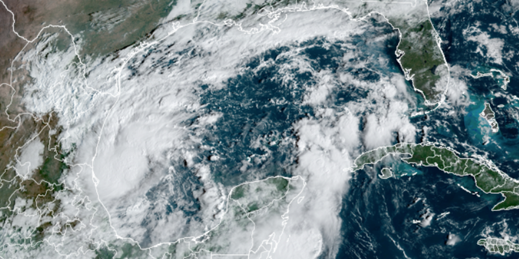
The latest National Hurricane Center update for Hurricane Milton:

BULLETIN
Hurricane Milton Intermediate Advisory Number 5A
NWS National Hurricane Center Miami FL AL142024
100 PM CDT Sun Oct 06 2024

...AIR FORCE HURRICANE HUNTERS FIND MILTON RAPIDLY INTENSIFYING
INTO A HURRICANE...


SUMMARY OF 100 PM CDT...1800 UTC...INFORMATION
----------------------------------------------
LOCATION...22.5N 94.0W
ABOUT 290 MI...465 KM WNW OF PROGRESO MEXICO
ABOUT 815 MI...1310 KM WSW OF TAMPA FLORIDA
MAXIMUM SUSTAINED WINDS...80 MPH...130 KM/H
PRESENT MOVEMENT...E OR 100 DEGREES AT 6 MPH...9 KM/H
MINIMUM CENTRAL PRESSURE...988 MB...29.18 INCHES


WATCHES AND WARNINGS
--------------------
CHANGES WITH THIS ADVISORY:

None.

SUMMARY OF WATCHES AND WARNINGS IN EFFECT:

A Tropical Storm Warning is in effect for...
* Celestun to Cabo Catoche

A Tropical Storm Watch is in effect for...
* East of Cabo Catoche to Cancun

A Tropical Storm Warning means that tropical storm conditions are
expected somewhere within the warning area within 36 hours.

A Tropical Storm Watch means that tropical storm conditions are
possible within the watch area, generally within 48 hours.

Interests in the remainder of the Yucatan peninsula of Mexico, the
Florida Peninsula, the Florida Keys, and the northwestern Bahamas
should monitor the progress of this system.

Hurricane and Storm Surge Watches could be required for
portions of Florida late today.

For storm information specific to your area, please monitor
products issued by your national meteorological service.

DISCUSSION AND OUTLOOK
----------------------
At 100 PM CDT (1800 UTC), the center of Hurricane Milton was
located by an Air Force Reserve Hurricane Hunter aircraft near
latitude 22.5 North, longitude 94.0 West. Milton is moving toward
the east near 6 mph (9 km/h), and this general motion is expected
today. An eastward to east-northeastward motion is forecast on
Monday, followed by a faster northeastward motion on Tuesday and
Wednesday. On the forecast track, Milton is forecast to move north
of the Yucatan Peninsula and to move across the Gulf of Mexico and
approach the west coast of the Florida Peninsula by midweek.

Maximum sustained winds have increased to near 80 mph (130 km/h)
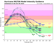
with higher gusts. Milton is forecast to rapidly intensify during
the next couple of days and become a major hurricane on Monday.

Hurricane-force winds extend outward up to 20 miles (30 km) from
the center and tropical-storm-force winds extend outward up to 80
miles (130 km) from the center.

The estimated minimum central pressure is 988 mb (29.18 inches)
based on Air Force dropsonde data.

 
TAMPA – Florida is preparing for what will likely be the largest evacuation the state has seen since 2017

 
Wow, low chance it might be a Cat 5. Probably still be a Cat 4 when it hit but it’s going to push a lot of water ahead and inland.

IMG_8001.png
 
Thread title edited to reflect hurricane strength.

Milton is still on track for Tampa Bay area and forecast to become a dangerous Category 4 storm. Tropical storm-force winds expected Tuesday night/Wednesday morning.

Do not forget that these storms are notoriously difficult to predict. The Carolinas were nowhere close to the path cone for Helene until 12 hours before it nailed them. Anyone anywhere in Central Florida, including the east coast, should be prepared to evacuate to a safe location.

Milton is predicted to drop to tropical storm strength once it passes over Florida, but once over the open waters of the Atlantic it could theoretically redevelop into a hurricane and threaten the east coast of the US next week. Keep any eye on this storm even after it passes.
 
UPDATE: New 12z consensus model is in. They are historically better performing over the years. Magenta is the most recent, Red is 12 hours ago, Orange is 24 hours ago. More adjustments, both north or south, will continue. Look for consistency. Southwest Florida, please take this seriously. I'll continue to keep you updated on
@WINKNews

 
The storm had intensified 80+ kts in 12hrs. It is just shy of (or may already now be) a Cat 5. As is the case from west to east Gulf Hurricanes it will almost certainly fall back to Strong Cat 4. before land fall near Tampa.

Source: latest NWS Discussion.
 
Status
Not open for further replies.
Back
Top Bottom