

- Joined
- Mar 22, 2015
- Location
- Untied States of America
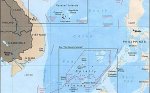
On 14 July 2017 Deputy Minister of Maritime Affairs Arif Havas Oegroseno officially launched the new map of the Republic of Indonesia, pointing out that the Natuna Exclusive Economic Zone (EEZ) has been renamed as “Laut Natuna Utara” (North Natuna Sea). The area is part of the South China Sea. Moreover, The Natuna EEZ lies partially within China’s “Nine-Dash Line”, which has not been recognized by Indonesia.
The new map, prepared over nine months from October 2016, was signed by 21 Indonesian ministers and state agencies.
Havas explained that the renaming is being done for two reasons: First, it is to prevent confusion among exploiters on the continental shelf as regards territorial sovereignty; and second, to provide clear guidelines to the Law Enforcement Team of the Indonesian Navy. However, as Indonesia did not consult its immediate neighbours in preparing the updated map, the new maritime boundaries as reflected on the map may be disputed in the future.
Havas claimed that “we don’t have a territorial dispute with China,” and that the renaming is quite normal. Yet he added that “Indonesia will not negotiate with countries who claim sovereignty without reference to the UNCLOS.”
http://www.eurasiareview.com/18082017-what-does-indonesias-renaming-of-part-of-south-china-sea-signify-analysis/?utm_content=buffere931b&utm_medium=social&utm_source=twitter.com&utm_campaign=buffer
The new map, prepared over nine months from October 2016, was signed by 21 Indonesian ministers and state agencies.
Havas explained that the renaming is being done for two reasons: First, it is to prevent confusion among exploiters on the continental shelf as regards territorial sovereignty; and second, to provide clear guidelines to the Law Enforcement Team of the Indonesian Navy. However, as Indonesia did not consult its immediate neighbours in preparing the updated map, the new maritime boundaries as reflected on the map may be disputed in the future.
Havas claimed that “we don’t have a territorial dispute with China,” and that the renaming is quite normal. Yet he added that “Indonesia will not negotiate with countries who claim sovereignty without reference to the UNCLOS.”
http://www.eurasiareview.com/18082017-what-does-indonesias-renaming-of-part-of-south-china-sea-signify-analysis/?utm_content=buffere931b&utm_medium=social&utm_source=twitter.com&utm_campaign=buffer